
Nantwich topographic map
Interactive map
Click on the map to display elevation.
About this map
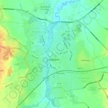
Name: Nantwich topographic map, elevation, terrain.
Location: Nantwich, Cheshire East, England, United Kingdom (53.05219 -2.54047 53.08552 -2.49598)
Average elevation: 45 m
Minimum elevation: 31 m
Maximum elevation: 66 m
Other topographic maps
Click on a map to view its topography, its elevation and its terrain.
Langley
United Kingdom > England > Cheshire East
Langley, Cheshire East, England, SK11 0DG, United Kingdom
Average elevation: 244 m