
Thank you for supporting this site ❤️
Make a donation
Make a donation
Farsleben topographic map
Click on the map to display elevation.
Thank you for supporting this site ❤️
Make a donation
Make a donation
About this map
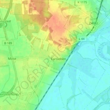
Name: Farsleben topographic map, elevation, terrain.
Location: Farsleben, Wolmirstedt, Börde, Sachsen-Anhalt, Deutschland (52.25779 11.63425 52.29660 11.68213)
Average elevation: 55 m
Minimum elevation: 39 m
Maximum elevation: 79 m
Thank you for supporting this site ❤️
Make a donation
Make a donation
Other topographic maps
Click on a map to view its topography, its elevation and its terrain.