
Thank you for supporting this site ❤️
Make a donation
Make a donation
Longdon topographic map
Click on the map to display elevation.
Thank you for supporting this site ❤️
Make a donation
Make a donation
About this map
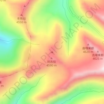
Name: Longdon topographic map, elevation, terrain.
Location: Longdon, Shangyadong, Yadong County, Shigatse, Tibet, China (27.54936 89.04026 27.54946 89.04036)
Average elevation: 4,438 m
Minimum elevation: 4,120 m
Maximum elevation: 4,689 m
Thank you for supporting this site ❤️
Make a donation
Make a donation
Other topographic maps
Click on a map to view its topography, its elevation and its terrain.