
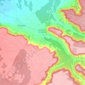
Santibáñez de Valcorba topographic map
Interactive map
Click on the map to display elevation.
About this map
Name: Santibáñez de Valcorba topographic map, elevation, terrain.
Location: Santibáñez de Valcorba, Valladolid, Castilla y León, España (41.53138 -4.46905 41.58949 -4.36643)
Average elevation: 810 m
Minimum elevation: 715 m
Maximum elevation: 882 m