
Salisbury topographic map
Interactive map
Click on the map to display elevation.
About this map
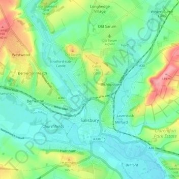
Name: Salisbury topographic map, elevation, terrain.
Location: Salisbury, Wiltshire, England, United Kingdom (51.04853 -1.85026 51.11089 -1.76821)
Average elevation: 72 m
Minimum elevation: 39 m
Maximum elevation: 150 m
Bishop of Salisbury Hubert Walter was instrumental in the negotiations with Saladin during the Third Crusade, but he spent little time in his diocese prior to his elevation to archbishop of Canterbury. The brothers Herbert and Richard Poore succeeded him and began planning the relocation of the cathedral into the valley almost immediately. Their plans were approved by King Richard I but repeatedly delayed: Herbert was first forced into exile in Normandy in the 1190s by the hostility of his archbishop Walter and then again to Scotland in the 1210s owing to royal hostility following the papal interdiction against King John. The secular authorities were particularly incensed, according to tradition, owing to some of the clerics debauching the castellan's female relations. In the end, the clerics were refused permission to reenter the city walls following their rogations and processions. This caused Peter of Blois to describe the church as "a captive within the walls of the citadel like the ark of God in the profane house of Baal". He advocated
Other topographic maps
Click on a map to view its topography, its elevation and its terrain.
Edington
United Kingdom > England > Wiltshire
Edington, Wiltshire, England, United Kingdom
Average elevation: 133 m
West Amesbury
United Kingdom > England > Wiltshire
West Amesbury, Wiltshire, England, SP4 7BH, United Kingdom
Average elevation: 90 m
Ramsbury
United Kingdom > England > Wiltshire
Ramsbury, Wiltshire, England, United Kingdom
Average elevation: 164 m
Broad Chalke
United Kingdom > England > Wiltshire
Broad Chalke, Wiltshire, England, United Kingdom
Average elevation: 134 m
Reybridge
United Kingdom > England > Wiltshire > Lacock
Reybridge, Lacock, Wiltshire, England, SN15 2PB, United Kingdom
Average elevation: 65 m
Downton
United Kingdom > England > Wiltshire
Downton, Wiltshire, England, United Kingdom
Average elevation: 74 m
Nomansland
United Kingdom > England > Wiltshire
Nomansland, Landford, Wiltshire, England, SP5 2BU, United Kingdom
Average elevation: 68 m
Great Bedwyn
United Kingdom > England > Wiltshire
Great Bedwyn, Wiltshire, England, United Kingdom
Average elevation: 151 m
Botley Hill
United Kingdom > England > Wiltshire
Botley Hill, Wiltshire, England, SN8 3NF, United Kingdom
Average elevation: 178 m
Hippenscombe
United Kingdom > England > Wiltshire
Hippenscombe, Tidcombe and Fosbury, Wiltshire, England, SN8 3NW, United Kingdom
Average elevation: 214 m
Chippenham
United Kingdom > England > Wiltshire
Chippenham, Wiltshire, England, United Kingdom
Average elevation: 63 m
Malmesbury
United Kingdom > England > Wiltshire > Malmesbury
Malmesbury, Wiltshire, South West England, England, United Kingdom
Average elevation: 84 m
Jugg's Wood
United Kingdom > England > Wiltshire > Froxfield
Jugg's Wood, Froxfield, Wiltshire, South West England, England, United Kingdom
Average elevation: 131 m
Hawkeridge
United Kingdom > England > Wiltshire > Hawkeridge
Hawkeridge, Wiltshire, South West England, England, BA13 4LA, United Kingdom
Average elevation: 57 m
Lower Chicksgrove
United Kingdom > England > Wiltshire > Lower Chicksgrove
Lower Chicksgrove, Sutton Mandeville, Wiltshire, South West England, England, SP3 6NA, United Kingdom
Average elevation: 120 m
Tisbury
United Kingdom > England > Wiltshire
Tisbury, Wiltshire, England, United Kingdom
Average elevation: 127 m
Hullavington
United Kingdom > England > Wiltshire > Hullavington
Hullavington, Wiltshire, South West England, England, United Kingdom
Average elevation: 99 m
Southwick
United Kingdom > England > Wiltshire
Southwick, Wiltshire, England, United Kingdom
Average elevation: 57 m
Pewsey
United Kingdom > England > Wiltshire > Pewsey
Pewsey, Wiltshire, South West England, England, United Kingdom
Average elevation: 146 m
West Kennett
United Kingdom > England > Wiltshire
West Kennett, Avebury, Wiltshire, England, SN8 1QF, United Kingdom
Average elevation: 174 m
Devizes
United Kingdom > England > Wiltshire
Devizes, Wiltshire, England, United Kingdom
Average elevation: 118 m
Trowbridge
United Kingdom > England > Wiltshire
Trowbridge, Wiltshire, England, United Kingdom
Average elevation: 47 m
Netheravon
United Kingdom > England > Wiltshire
Netheravon, Wiltshire, England, United Kingdom
Average elevation: 116 m
Warminster
United Kingdom > England > Wiltshire
Warminster, Wiltshire, England, United Kingdom
Average elevation: 143 m
Larkhill
United Kingdom > England > Wiltshire > Larkhill
Larkhill, Wiltshire, England, SP4 8QB, United Kingdom
Average elevation: 111 m
Bodenham
United Kingdom > England > Wiltshire
Bodenham, Wiltshire, England, SP5 4ES, United Kingdom
Average elevation: 62 m
Maiden Bradley
United Kingdom > England > Wiltshire > Maiden Bradley
Maiden Bradley, Wiltshire, South West England, England, BA12 7, United Kingdom
Average elevation: 186 m