
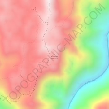
Cuchilla El Uvital topographic map
Interactive map
Click on the map to display elevation.
About this map
Name: Cuchilla El Uvital topographic map, elevation, terrain.
Location: Cuchilla El Uvital, San Luis, Oriente, Antioquia, Colombia (6.02328 -74.93894 6.02338 -74.93884)
Average elevation: 741 m
Minimum elevation: 324 m
Maximum elevation: 996 m
Other topographic maps
Click on a map to view its topography, its elevation and its terrain.
El Prodigio
Colombia > Antioquia > San Luis > El Prodigio
El Prodigio, San Luis, Oriente, Antioquia, Colombia
Average elevation: 474 m