
Thank you for supporting this site ❤️
Make a donation
Make a donation
Kota Samarahan topographic map
Click on the map to display elevation.
Thank you for supporting this site ❤️
Make a donation
Make a donation
Kota Samarahan
On 19 August 1983, the Muara Tuang subdistrict was elevated to a full district status, and renamed as Samarahan District. In line with the status elevation, the Muara Tuang bazaar was elevated to a township, and renamed to Kota Samarahan.
Thank you for supporting this site ❤️
Make a donation
Make a donation
About this map
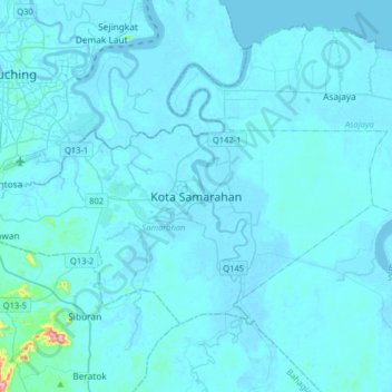
Name: Kota Samarahan topographic map, elevation, terrain.
Average elevation: 9 m
Minimum elevation: -5 m
Maximum elevation: 304 m
Thank you for supporting this site ❤️
Make a donation
Make a donation
Other topographic maps
Click on a map to view its topography, its elevation and its terrain.