
Pottawatomie County topographic map
Interactive map
Click on the map to display elevation.
About this map
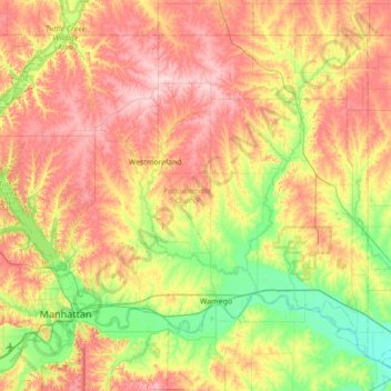
Name: Pottawatomie County topographic map, elevation, terrain.
Location: Pottawatomie County, Kansas, United States of America (39.12638 -96.72774 39.56623 -96.03557)
Average elevation: 367 m
Minimum elevation: 278 m
Maximum elevation: 474 m
Other topographic maps
Click on a map to view its topography, its elevation and its terrain.
Lawrence
United States of America > Kansas > Lawrence
Lawrence, Douglas County, Kansas, United States of America
Average elevation: 265 m
Greenwood County
United States of America > Kansas
Greenwood County, Kansas, United States of America
Average elevation: 372 m
Seward County
United States of America > Kansas
Seward County, Kansas, United States of America
Average elevation: 866 m