
Thank you for supporting this site ❤️
Make a donation
Make a donation
Houtaing topographic map
Click on the map to display elevation.
Thank you for supporting this site ❤️
Make a donation
Make a donation
About this map
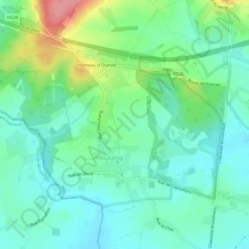
Name: Houtaing topographic map, elevation, terrain.
Location: Houtaing, Ath, Hainaut, Wallonie, Belgique (50.63314 3.65511 50.65481 3.70194)
Average elevation: 69 m
Minimum elevation: 41 m
Maximum elevation: 138 m
Thank you for supporting this site ❤️
Make a donation
Make a donation
Other topographic maps
Click on a map to view its topography, its elevation and its terrain.