
Sankt Agatha topographic map
Interactive map
Click on the map to display elevation.
About this map
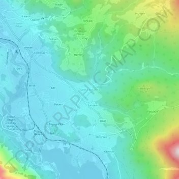
Name: Sankt Agatha topographic map, elevation, terrain.
Average elevation: 654 m
Minimum elevation: 495 m
Maximum elevation: 1,281 m
Other topographic maps
Click on a map to view its topography, its elevation and its terrain.
Sarstein
Österreich > Oberösterreich > Bezirk Gmunden > Bad Goisern am Hallstättersee > Sankt Agatha > Sarstein
Sarstein, Sankt Agatha, Bad Goisern am Hallstättersee, Bezirk Gmunden, Oberösterreich, 4822, Österreich
Average elevation: 657 m