
Quinsigamond Pond Dam topographic map
Interactive map
Click on the map to display elevation.
About this map
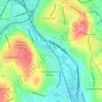
Name: Quinsigamond Pond Dam topographic map, elevation, terrain.
Location: Quinsigamond Pond Dam, Worcester, Massachusetts, 01607, USA (42.23504 -71.79623 42.23514 -71.79613)
Average elevation: 163 m
Minimum elevation: 126 m
Maximum elevation: 221 m
Other topographic maps
Click on a map to view its topography, its elevation and its terrain.
Rockwood Field
USA > Massachusetts > Worcester
Rockwood Field, Tatnuck Square, Worcester, Massachusetts, USA
Average elevation: 192 m