
Detmold topographic map
Interactive map
Click on the map to display elevation.
About this map
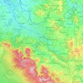
Name: Detmold topographic map, elevation, terrain.
Location: Detmold, Kreis Lippe, Rhénanie-du-Nord-Westphalie, Allemagne (51.85873 8.76308 51.99827 8.98958)
Average elevation: 202 m
Minimum elevation: 95 m
Maximum elevation: 427 m
Other topographic maps
Click on a map to view its topography, its elevation and its terrain.
Bad Salzuflen
Allemagne > Rhénanie-du-Nord-Westphalie > Kreis Lippe
Bad Salzuflen, Kreis Lippe, Rhénanie-du-Nord-Westphalie, Allemagne
Average elevation: 120 m