
Thank you for supporting this site ❤️
Make a donation
Make a donation
Howe topographic map
Click on the map to display elevation.
Thank you for supporting this site ❤️
Make a donation
Make a donation
About this map
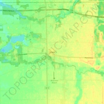
Name: Howe topographic map, elevation, terrain.
Location: Howe, LaGrange County, Indiana, 46746, United States (41.68137 -85.46065 41.76137 -85.38065)
Average elevation: 267 m
Minimum elevation: 253 m
Maximum elevation: 277 m
Thank you for supporting this site ❤️
Make a donation
Make a donation
Other topographic maps
Click on a map to view its topography, its elevation and its terrain.