
Thank you for supporting this site ❤️
Make a donation
Make a donation
Perry Center topographic map
Click on the map to display elevation.
Thank you for supporting this site ❤️
Make a donation
Make a donation
About this map
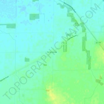
Name: Perry Center topographic map, elevation, terrain.
Location: Perry Center, Wood County, Ohio, 43467, United States (41.18978 -83.49826 41.22978 -83.45826)
Average elevation: 223 m
Minimum elevation: 217 m
Maximum elevation: 234 m
Thank you for supporting this site ❤️
Make a donation
Make a donation
Other topographic maps
Click on a map to view its topography, its elevation and its terrain.
Thank you for supporting this site ❤️
Make a donation
Make a donation
Thank you for supporting this site ❤️
Make a donation
Make a donation