
Mise topographic map
Interactive map
Click on the map to display elevation.
About this map
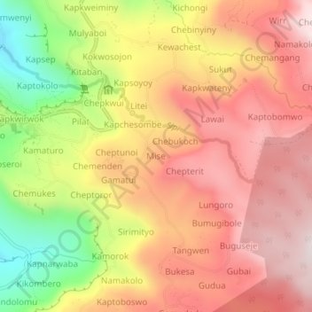
Name: Mise topographic map, elevation, terrain.
Location: Mise, Kapchorwa, Eastern Region, Ouganda (1.30953 34.36921 1.34953 34.40921)
Average elevation: 1,896 m
Minimum elevation: 1,483 m
Maximum elevation: 2,174 m
Other topographic maps
Click on a map to view its topography, its elevation and its terrain.
Sipi Falls - Simba
Sipi Falls - Simba, Kapchorwa, Eastern Region, Ouganda
Average elevation: 1,854 m