
Thank you for supporting this site ❤️
Make a donation
Make a donation
Luppa topographic map
Click on the map to display elevation.
Thank you for supporting this site ❤️
Make a donation
Make a donation
Luppa
2002 fand bereits das dritte Dreschmaschinenfest in Luppa statt. Höhepunkt des Festes ist ein Umzug mit historischer Landmaschinentechnik.
Thank you for supporting this site ❤️
Make a donation
Make a donation
About this map
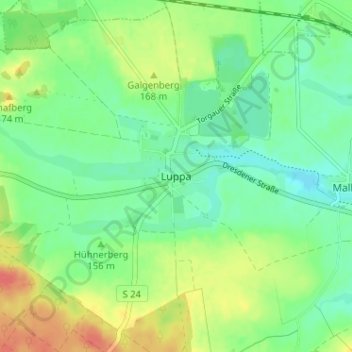
Name: Luppa topographic map, elevation, terrain.
Location: Luppa, Wermsdorf, Nordsachsen, Sachsen, 04779, Deutschland (51.31311 12.94002 51.35311 12.98002)
Average elevation: 155 m
Minimum elevation: 136 m
Maximum elevation: 187 m
Thank you for supporting this site ❤️
Make a donation
Make a donation
Other topographic maps
Click on a map to view its topography, its elevation and its terrain.