
Thank you for supporting this site ❤️
Make a donation
Make a donation
Glenns topographic map
Click on the map to display elevation.
Thank you for supporting this site ❤️
Make a donation
Make a donation
About this map
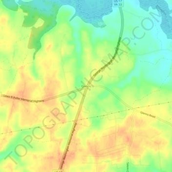
Name: Glenns topographic map, elevation, terrain.
Location: Glenns, Gloucester County, Virginia, 23149, United States (37.54585 -76.63296 37.58585 -76.59296)
Average elevation: 23 m
Minimum elevation: 0 m
Maximum elevation: 40 m
Thank you for supporting this site ❤️
Make a donation
Make a donation
Other topographic maps
Click on a map to view its topography, its elevation and its terrain.
Gloucester Point
United States > Virginia > Gloucester County > Gloucester Point
Average elevation: 5 m