
Thank you for supporting this site ❤️
Make a donation
Make a donation
Eindalsfjall topographic map
Click on the map to display elevation.
Thank you for supporting this site ❤️
Make a donation
Make a donation
About this map
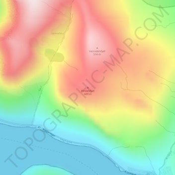
Name: Eindalsfjall topographic map, elevation, terrain.
Location: Eindalsfjall, Sørvágur, Vága sýsla, 380, Færøerne (62.08713 -7.33062 62.08723 -7.33052)
Average elevation: 251 m
Minimum elevation: -12 m
Maximum elevation: 538 m
Thank you for supporting this site ❤️
Make a donation
Make a donation