
Thank you for supporting this site ❤️
Make a donation
Make a donation
Zhuhai topographic map
Click on the map to display elevation.
Thank you for supporting this site ❤️
Make a donation
Make a donation
About this map
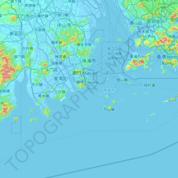
Name: Zhuhai topographic map, elevation, terrain.
Location: Zhuhai, Guangdong Province, China (21.66062 113.05819 22.48580 114.38888)
Average elevation: 22 m
Minimum elevation: -7 m
Maximum elevation: 916 m
Thank you for supporting this site ❤️
Make a donation
Make a donation
Other topographic maps
Click on a map to view its topography, its elevation and its terrain.