
Thank you for supporting this site ❤️
Make a donation
Make a donation
Zwedru topographic map
Click on the map to display elevation.
Thank you for supporting this site ❤️
Make a donation
Make a donation
About this map
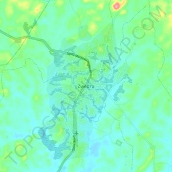
Name: Zwedru topographic map, elevation, terrain.
Location: Zwedru, Zone 2, Tchien, Grand Gedeh County, Liberia (6.02872 -8.17427 6.10872 -8.09427)
Average elevation: 214 m
Minimum elevation: 193 m
Maximum elevation: 291 m
Thank you for supporting this site ❤️
Make a donation
Make a donation
Other topographic maps
Click on a map to view its topography, its elevation and its terrain.