
Neurur topographic map
Interactive map
Click on the map to display elevation.
About this map
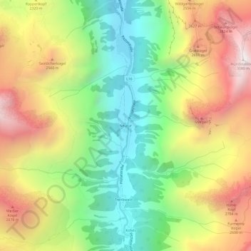
Name: Neurur topographic map, elevation, terrain.
Average elevation: 2,130 m
Minimum elevation: 1,417 m
Maximum elevation: 3,031 m
Other topographic maps
Click on a map to view its topography, its elevation and its terrain.
Pitztal
Oostenrijk > Bezirk Imst > Sankt Leonhard im Pitztal
Pitztal, Sankt Leonhard im Pitztal, Arzl im Pitztal, Bezirk Imst, Oostenrijk
Average elevation: 2,005 m