
Thank you for supporting this site ❤️
Make a donation
Make a donation
Carasuchi topographic map
Click on the map to display elevation.
Thank you for supporting this site ❤️
Make a donation
Make a donation
About this map
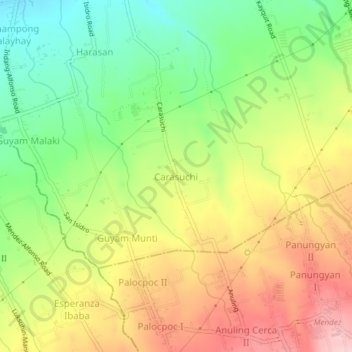
Name: Carasuchi topographic map, elevation, terrain.
Location: Carasuchi, Indang, Cavite, Calabarzon, 4122, Philippines (14.12571 120.85952 14.16571 120.89952)
Average elevation: 438 m
Minimum elevation: 351 m
Maximum elevation: 532 m
Thank you for supporting this site ❤️
Make a donation
Make a donation
Other topographic maps
Click on a map to view its topography, its elevation and its terrain.