
Thank you for supporting this site ❤️
Make a donation
Make a donation
Haakonsvern topographic map
Click on the map to display elevation.
Thank you for supporting this site ❤️
Make a donation
Make a donation
About this map
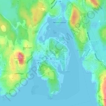
Name: Haakonsvern topographic map, elevation, terrain.
Location: Haakonsvern, Mathopen, Laksevåg, Bergen, Vestland, 5173, Norway (60.32923 5.21813 60.34923 5.23813)
Average elevation: 26 m
Minimum elevation: -4 m
Maximum elevation: 119 m
Thank you for supporting this site ❤️
Make a donation
Make a donation
Other topographic maps
Click on a map to view its topography, its elevation and its terrain.