
Thank you for supporting this site ❤️
Make a donation
Make a donation
LeRoy topographic map
Click on the map to display elevation.
Thank you for supporting this site ❤️
Make a donation
Make a donation
About this map
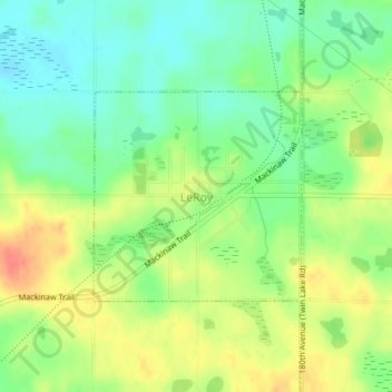
Name: LeRoy topographic map, elevation, terrain.
Location: LeRoy, Osceola County, Michigan, United States (44.03086 -85.46382 44.04532 -85.44382)
Average elevation: 379 m
Minimum elevation: 357 m
Maximum elevation: 405 m
Thank you for supporting this site ❤️
Make a donation
Make a donation
Other topographic maps
Click on a map to view its topography, its elevation and its terrain.