
La Capelle topographic map
Interactive map
Click on the map to display elevation.
About this map
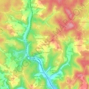
Name: La Capelle topographic map, elevation, terrain.
Average elevation: 240 m
Minimum elevation: 166 m
Maximum elevation: 304 m
Other topographic maps
Click on a map to view its topography, its elevation and its terrain.
Les Gouyoux
France > Nouvelle-Aquitaine > Dordogne > Saint-Cernin-de-l'Herm
Les Gouyoux, Saint-Cernin-de-l'Herm, Sarlat-la-Canéda, Dordogne, Nouvelle-Aquitaine, France métropolitaine, 24550, France
Average elevation: 244 m