
Thank you for supporting this site ❤️
Make a donation
Make a donation
Gid topographic map
Click on the map to display elevation.
Thank you for supporting this site ❤️
Make a donation
Make a donation
About this map
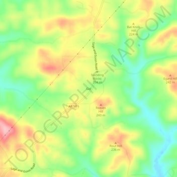
Name: Gid topographic map, elevation, terrain.
Location: Gid, Izard County, Arkansas, United States (35.95979 -91.87654 35.99979 -91.83654)
Average elevation: 196 m
Minimum elevation: 127 m
Maximum elevation: 274 m
Thank you for supporting this site ❤️
Make a donation
Make a donation
Other topographic maps
Click on a map to view its topography, its elevation and its terrain.