
Thank you for supporting this site ❤️
Make a donation
Make a donation
Gunung Ungaran topographic map
Click on the map to display elevation.
Thank you for supporting this site ❤️
Make a donation
Make a donation
About this map
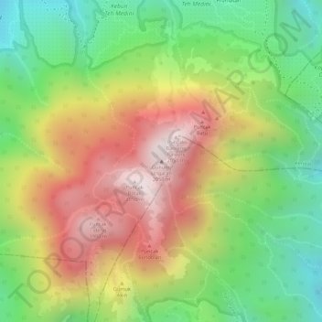
Name: Gunung Ungaran topographic map, elevation, terrain.
Location: Gunung Ungaran, Kendal, Central Java, Java, 50665, Indonesia (-7.18567 110.34704 -7.18557 110.34714)
Average elevation: 1,632 m
Minimum elevation: 1,275 m
Maximum elevation: 2,006 m
Thank you for supporting this site ❤️
Make a donation
Make a donation