
Thank you for supporting this site ❤️
Make a donation
Make a donation
Langwiese topographic map
Click on the map to display elevation.
Thank you for supporting this site ❤️
Make a donation
Make a donation
About this map
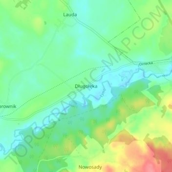
Name: Langwiese topographic map, elevation, terrain.
Average elevation: 80 m
Minimum elevation: 58 m
Maximum elevation: 129 m
Thank you for supporting this site ❤️
Make a donation
Make a donation
Other topographic maps
Click on a map to view its topography, its elevation and its terrain.
Wormditt
Polen > Woiwodschaft Ermland-Masuren > powiat lidzbarski
Die Höhe der Stadt gegenüber dem Meeresspiegel der Ostsee beträgt 69,5 Meter.
Average elevation: 66 m