
Thank you for supporting this site ❤️
Make a donation
Make a donation
Wilmore topographic map
Click on the map to display elevation.
Thank you for supporting this site ❤️
Make a donation
Make a donation
About this map
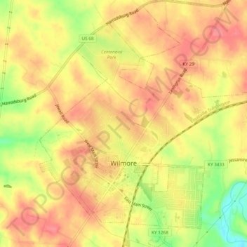
Name: Wilmore topographic map, elevation, terrain.
Location: Wilmore, Jessamine County, Kentucky, 40390, United States (37.85174 -84.69137 37.91597 -84.62651)
Average elevation: 268 m
Minimum elevation: 159 m
Maximum elevation: 299 m
Thank you for supporting this site ❤️
Make a donation
Make a donation
Other topographic maps
Click on a map to view its topography, its elevation and its terrain.