
Thank you for supporting this site ❤️
Make a donation
Make a donation
Khyalganat topographic map
Click on the map to display elevation.
Thank you for supporting this site ❤️
Make a donation
Make a donation
About this map
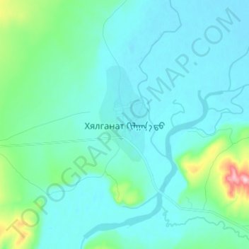
Name: Khyalganat topographic map, elevation, terrain.
Location: Khyalganat, Khangal, Bulgan, Mongolia (49.46190 104.24909 49.54190 104.32909)
Average elevation: 797 m
Minimum elevation: 760 m
Maximum elevation: 1,029 m
Thank you for supporting this site ❤️
Make a donation
Make a donation