
Thank you for supporting this site ❤️
Make a donation
Make a donation
Pishin topographic map
Click on the map to display elevation.
Thank you for supporting this site ❤️
Make a donation
Make a donation
Pishin
Pishin has an altitude of 219 metres (721 feet). It is near the Pakistani border, across which is the town of Mand to the east. The Iranian government has set up a customs post to develop border trade between Iran and Pakistan.
Thank you for supporting this site ❤️
Make a donation
Make a donation
About this map
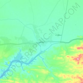
Name: Pishin topographic map, elevation, terrain.
Average elevation: 240 m
Minimum elevation: 202 m
Maximum elevation: 364 m
Thank you for supporting this site ❤️
Make a donation
Make a donation
Other topographic maps
Click on a map to view its topography, its elevation and its terrain.