
Thank you for supporting this site ❤️
Make a donation
Make a donation
Yastrebets topographic map
Click on the map to display elevation.
Thank you for supporting this site ❤️
Make a donation
Make a donation
About this map
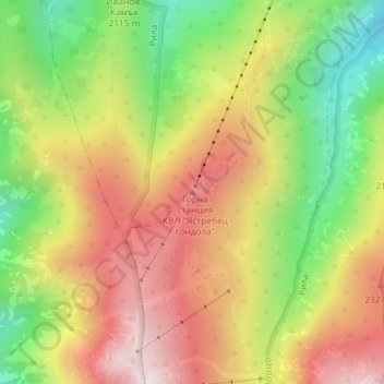
Name: Yastrebets topographic map, elevation, terrain.
Location: Yastrebets, Samokov, Sofia, 2010, Bulgaria (42.22658 23.58057 42.22668 23.58067)
Average elevation: 2,134 m
Minimum elevation: 1,771 m
Maximum elevation: 2,476 m
Thank you for supporting this site ❤️
Make a donation
Make a donation