
Ήλια topographic map
Interactive map
Click on the map to display elevation.
About this map
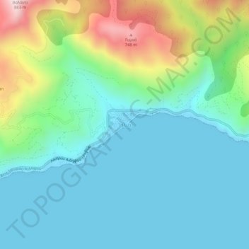
Name: Ήλια topographic map, elevation, terrain.
Average elevation: 200 m
Minimum elevation: -3 m
Maximum elevation: 837 m
Other topographic maps
Click on a map to view its topography, its elevation and its terrain.
Aidipsos
Greece > Thessaly and Central Greece > Euboea Regional Unit
Aidipsos, Istiaia-Aidipsos Municipality, Euboea Regional Unit, Central Greece, Thessaly and Central Greece, 343 00, Greece
Average elevation: 113 m