
Ascot topographic map
Interactive map
Click on the map to display elevation.
About this map
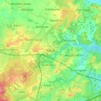
Name: Ascot topographic map, elevation, terrain.
Average elevation: 72 m
Minimum elevation: 37 m
Maximum elevation: 130 m
Other topographic maps
Click on a map to view its topography, its elevation and its terrain.
Maidenhead
Royaume-Uni > Angleterre > Windsor and Maidenhead
Maidenhead, Windsor and Maidenhead, Angleterre, SL6 1QB, Royaume-Uni
Average elevation: 41 m
Clewer Village
Royaume-Uni > Angleterre > Windsor and Maidenhead
Clewer Village, Windsor and Maidenhead, Angleterre, SL4 5JG, Royaume-Uni
Average elevation: 26 m