
Thank you for supporting this site ❤️
Make a donation
Make a donation
Easter Island topographic map
Click on the map to display elevation.
Thank you for supporting this site ❤️
Make a donation
Make a donation
About this map
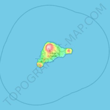
Name: Easter Island topographic map, elevation, terrain.
Location: Easter Island, Valparaíso, 2770000, Chile (-27.40200 -109.67958 -26.85500 -109.00299)
Average elevation: 5 m
Minimum elevation: 0 m
Maximum elevation: 501 m
Thank you for supporting this site ❤️
Make a donation
Make a donation