
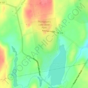
Thompson's Lake State Park topographic map
Interactive map
Click on the map to display elevation.
About this map
Name: Thompson's Lake State Park topographic map, elevation, terrain.
Average elevation: 410 m
Minimum elevation: 379 m
Maximum elevation: 450 m
Other topographic maps
Click on a map to view its topography, its elevation and its terrain.
West Township
United States > New York > Albany County > Town of Knox
West Township, Town of Knox, Albany County, New York, 12107, United States
Average elevation: 388 m
West Berne
United States > New York > Albany County > Town of Knox
West Berne, Town of Knox, Albany County, New York, 12023, United States
Average elevation: 322 m
East Township
United States > New York > Albany County > Town of Knox
East Township, Town of Knox, Albany County, New York, 12107, United States
Average elevation: 332 m