
Thank you for supporting this site ❤️
Make a donation
Make a donation
Burnside topographic map
Click on the map to display elevation.
Thank you for supporting this site ❤️
Make a donation
Make a donation
About this map
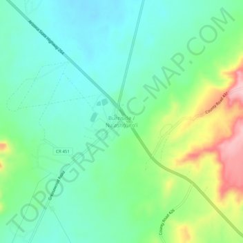
Name: Burnside topographic map, elevation, terrain.
Average elevation: 1,956 m
Minimum elevation: 1,904 m
Maximum elevation: 2,078 m
Thank you for supporting this site ❤️
Make a donation
Make a donation
Other topographic maps
Click on a map to view its topography, its elevation and its terrain.
Thank you for supporting this site ❤️
Make a donation
Make a donation
Thank you for supporting this site ❤️
Make a donation
Make a donation
Window Rock
United States > Arizona > Apache County
Window Rock is categorized as being within the 6a USDA hardiness zone, meaning the average annual extreme minimum temperature is between −10 and −5 °F (−23 and −21 °C). The city is cooler than most of Arizona due to its high elevation.
Average elevation: 2,084 m
Thank you for supporting this site ❤️
Make a donation
Make a donation