
Thank you for supporting this site ❤️
Make a donation
Make a donation
Pleret topographic map
Click on the map to display elevation.
Thank you for supporting this site ❤️
Make a donation
Make a donation
About this map
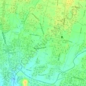
Name: Pleret topographic map, elevation, terrain.
Average elevation: 57 m
Minimum elevation: 42 m
Maximum elevation: 73 m
Thank you for supporting this site ❤️
Make a donation
Make a donation
Other topographic maps
Click on a map to view its topography, its elevation and its terrain.
Gunung Malang
Indonesia > Special Region of Yogyakarta > Bantul Regency > Segoroyoso
Average elevation: 75 m
Gapuro Gedongkuning
Indonesia > Special Region of Yogyakarta > Bantul Regency > Banguntapan
Average elevation: 103 m