
Thank you for supporting this site ❤️
Make a donation
Make a donation
Forville topographic map
Click on the map to display elevation.
Thank you for supporting this site ❤️
Make a donation
Make a donation
About this map
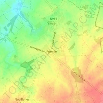
Name: Forville topographic map, elevation, terrain.
Location: Forville, Fernelmont, Namur, Wallonien, 5380, Belgien (50.55464 4.98067 50.59464 5.02067)
Average elevation: 167 m
Minimum elevation: 136 m
Maximum elevation: 195 m
Thank you for supporting this site ❤️
Make a donation
Make a donation
Other topographic maps
Click on a map to view its topography, its elevation and its terrain.
Thank you for supporting this site ❤️
Make a donation
Make a donation