
Thank you for supporting this site ❤️
Make a donation
Make a donation
Smeviken topographic map
Click on the map to display elevation.
Thank you for supporting this site ❤️
Make a donation
Make a donation
About this map
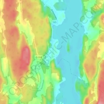
Name: Smeviken topographic map, elevation, terrain.
Location: Smeviken, Tanums kommun, Västra Götaland County, Sweden (58.64969 11.53184 58.68969 11.57184)
Average elevation: 83 m
Minimum elevation: 42 m
Maximum elevation: 146 m
Thank you for supporting this site ❤️
Make a donation
Make a donation
Other topographic maps
Click on a map to view its topography, its elevation and its terrain.