
Thank you for supporting this site ❤️
Make a donation
Make a donation
Mangaon topographic map
Click on the map to display elevation.
Thank you for supporting this site ❤️
Make a donation
Make a donation
About this map
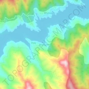
Name: Mangaon topographic map, elevation, terrain.
Location: Mangaon, Velhe, Pune District, Maharashtra, India (18.30955 73.50968 18.34955 73.54968)
Average elevation: 735 m
Minimum elevation: 624 m
Maximum elevation: 974 m
Thank you for supporting this site ❤️
Make a donation
Make a donation
Other topographic maps
Click on a map to view its topography, its elevation and its terrain.