
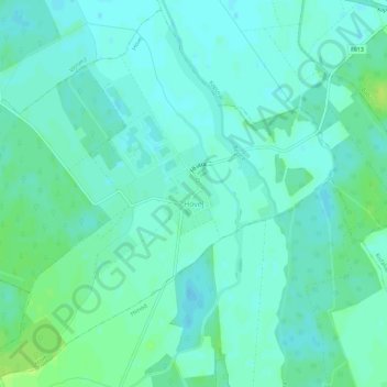
Hövej topographic map
Interactive map
Click on the map to display elevation.
About this map
Name: Hövej topographic map, elevation, terrain.
Average elevation: 124 m
Minimum elevation: 119 m
Maximum elevation: 132 m
Other topographic maps
Click on a map to view its topography, its elevation and its terrain.
Fertőd
Fertőd, Soproni járás, Győr-Moson-Sopron, Western Transdanubia, Transdanubia, Hungary
Average elevation: 119 m
Szerecseny
Szerecseny, Téti járás, Győr-Moson-Sopron, Western Transdanubia, Transdanubia, 9125, Hungary
Average elevation: 141 m
Fertőszentmiklós
Fertőszentmiklós, Soproni járás, Győr-Moson-Sopron, Western Transdanubia, Transdanubia, 9444, Hungary
Average elevation: 144 m
Mosonmagyaróvár
Mosonmagyaróvár, Mosonmagyaróvári járás, Győr-Moson-Sopron, Western Transdanubia, Transdanubia, Hungary
Average elevation: 120 m
Csorna
Csorna, Csornai járás, Győr-Moson-Sopron, Western Transdanubia, Transdanubia, Hungary
Average elevation: 115 m
Tárnokréti
Tárnokréti, Csornai járás, Győr-Moson-Sopron, Western Transdanubia, Transdanubia, 9165, Hungary
Average elevation: 112 m
Gönyű
Gönyű, Győri járás, Győr-Moson-Sopron, Western Transdanubia, Transdanubia, 9071, Hungary
Average elevation: 116 m
Abda
Hungary > Győr-Moson-Sopron > Abda
Abda, Győri járás, Győr-Moson-Sopron, Western Transdanubia, Transdanubia, 9151, Hungary
Average elevation: 112 m
Győrújbarát
Hungary > Győr-Moson-Sopron > Győrújbarát
Győrújbarát, Győri járás, Győr-Moson-Sopron, Western Transdanubia, Transdanubia, 9081, Hungary
Average elevation: 143 m
Farád
Hungary > Győr-Moson-Sopron > Farád
Farád, Csornai járás, Győr-Moson-Sopron, Western Transdanubia, Transdanubia, 9321, Hungary
Average elevation: 116 m
Gyor
Gyor, Győri járás, Győr-Moson-Sopron, Western Transdanubia, Transdanubia, Hungary
Average elevation: 120 m
Nyáras-sziget
Hungary > Győr-Moson-Sopron > Dunasziget
Nyáras-sziget, Dunasziget, Mosonmagyaróvári járás, Győr-Moson-Sopron, Western Transdanubia, Transdanubia, 9234, Hungary
Average elevation: 126 m
Kapuvár
Kapuvár, Kapuvári járás, Győr-Moson-Sopron, Western Transdanubia, Transdanubia, Hungary
Average elevation: 118 m
Ágfalva
Hungary > Győr-Moson-Sopron > Ágfalva > Ágfalva
Ágfalva, Soproni járás, Győr-Moson-Sopron, Western Transdanubia, Transdanubia, 9423, Hungary
Average elevation: 285 m
Sopron
Sopron, Soproni járás, Győr-Moson-Sopron, Western Transdanubia, Transdanubia, Hungary
Average elevation: 216 m