
Thank you for supporting this site ❤️
Make a donation
Make a donation
Aubry topographic map
Click on the map to display elevation.
Thank you for supporting this site ❤️
Make a donation
Make a donation
About this map
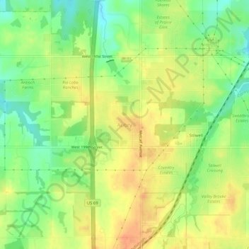
Name: Aubry topographic map, elevation, terrain.
Location: Aubry, Johnson County, Kansas, 66013, United States (38.75084 -94.69107 38.79084 -94.65107)
Average elevation: 325 m
Minimum elevation: 302 m
Maximum elevation: 344 m
Thank you for supporting this site ❤️
Make a donation
Make a donation
Other topographic maps
Click on a map to view its topography, its elevation and its terrain.
Thank you for supporting this site ❤️
Make a donation
Make a donation
Thank you for supporting this site ❤️
Make a donation
Make a donation
Thank you for supporting this site ❤️
Make a donation
Make a donation
Spring Hill
United States > Kansas > Johnson County
In 1856, James B. Hovey named the community after a town near Mobile, Alabama. "Being somewhat enthusiastic in my estimation of its future, it having all advantages of timber and water, and on a line that must be traveled between Olathe and Paola, I concluded to myself, as there was no one else to conclude…
Average elevation: 317 m
Thank you for supporting this site ❤️
Make a donation
Make a donation
Thank you for supporting this site ❤️
Make a donation
Make a donation
Thank you for supporting this site ❤️
Make a donation
Make a donation
Thank you for supporting this site ❤️
Make a donation
Make a donation