
Thank you for supporting this site ❤️
Make a donation
Make a donation
Marion topographic map
Click on the map to display elevation.
Thank you for supporting this site ❤️
Make a donation
Make a donation
About this map
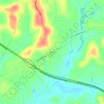
Name: Marion topographic map, elevation, terrain.
Location: Marion, Twiggs County, Georgia, United States (32.64237 -83.45712 32.68237 -83.41712)
Average elevation: 115 m
Minimum elevation: 88 m
Maximum elevation: 159 m
Thank you for supporting this site ❤️
Make a donation
Make a donation
Other topographic maps
Click on a map to view its topography, its elevation and its terrain.