
Make a donation
Mantua Center topographic map
Click on the map to display elevation.
Make a donation
About this map
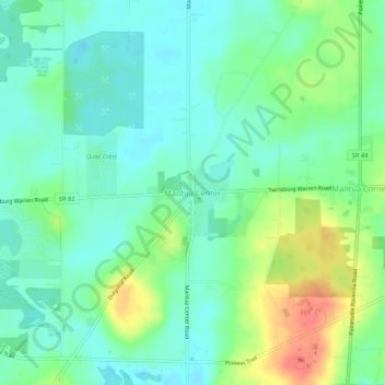
Name: Mantua Center topographic map, elevation, terrain.
Average elevation: 363 m
Minimum elevation: 344 m
Maximum elevation: 405 m
Make a donation
Other topographic maps
Click on a map to view its topography, its elevation and its terrain.
Kent
United States > Ohio > Portage County
Located on the western end of the Glaciated Allegheny Plateau, the topography of Kent includes rolling hills and varied terrain. The Cuyahoga River passes through the city, cutting a gorge with a drop of nearly 40 feet (10 m) adjacent to the downtown area. The United States Geological Survey lists the city's…
Average elevation: 328 m
Make a donation
Make a donation
Make a donation
Kent
United States > Ohio > Portage County
Located on the western end of the Glaciated Allegheny Plateau, the topography of Kent includes rolling hills and varied terrain. The Cuyahoga River passes through the city, cutting a gorge with a drop of nearly 40 feet (10 m) adjacent to the downtown area. The United States Geological Survey lists the city's…
Average elevation: 328 m
Make a donation