
Thank you for supporting this site ❤️
Make a donation
Make a donation
Yerraram topographic map
Click on the map to display elevation.
Thank you for supporting this site ❤️
Make a donation
Make a donation
About this map
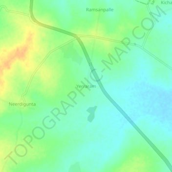
Name: Yerraram topographic map, elevation, terrain.
Location: Yerraram, Andole mandal, Sangareddy, Telangana, 502270, India (17.83863 77.99962 17.87863 78.03962)
Average elevation: 503 m
Minimum elevation: 491 m
Maximum elevation: 522 m
Thank you for supporting this site ❤️
Make a donation
Make a donation
Other topographic maps
Click on a map to view its topography, its elevation and its terrain.