
Make a donation
Hogg Mountain topographic map
Click on the map to display elevation.
Make a donation
About this map
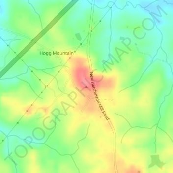
Name: Hogg Mountain topographic map, elevation, terrain.
Location: Hogg Mountain, Troup County, Georgia, United States (32.95341 -85.07360 32.95351 -85.07350)
Average elevation: 219 m
Minimum elevation: 187 m
Maximum elevation: 259 m
Make a donation
Other topographic maps
Click on a map to view its topography, its elevation and its terrain.
LaGrange
United States > Georgia > Troup County
LaGrange is named after the country estate near Paris of the wife of the Marquis de La Fayette. When La Fayette, a Revolutionary War hero, visited Georgia in 1825 on a national tour, he remarked on the similarity of local topography to his wife's property.
Average elevation: 220 m
Make a donation