
Thank you for supporting this site ❤️
Make a donation
Make a donation
Etas topographic map
Click on the map to display elevation.
Thank you for supporting this site ❤️
Make a donation
Make a donation
About this map
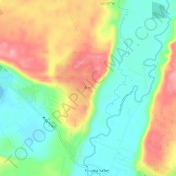
Name: Etas topographic map, elevation, terrain.
Location: Etas, Port Vila, Shefa Province, Vanuatu (-17.76885 168.36306 -17.72885 168.40306)
Average elevation: 52 m
Minimum elevation: 0 m
Maximum elevation: 122 m
Thank you for supporting this site ❤️
Make a donation
Make a donation