
Thank you for supporting this site ❤️
Make a donation
Make a donation
Lug topographic map
Click on the map to display elevation.
Thank you for supporting this site ❤️
Make a donation
Make a donation
About this map
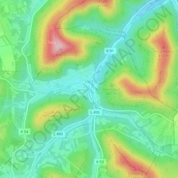
Name: Lug topographic map, elevation, terrain.
Location: Lug, Hauenstein, Südwestpfalz, Rijnland-Palts, Duitsland (49.17161 7.88323 49.19094 7.91665)
Average elevation: 283 m
Minimum elevation: 202 m
Maximum elevation: 437 m
Thank you for supporting this site ❤️
Make a donation
Make a donation
Other topographic maps
Click on a map to view its topography, its elevation and its terrain.