
Gschwandt topographic map
Interactive map
Click on the map to display elevation.
About this map
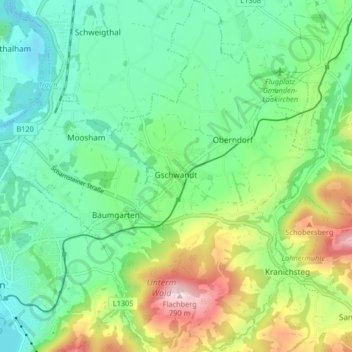
Name: Gschwandt topographic map, elevation, terrain.
Location: Gschwandt, Bezirk Gmunden, Oberösterreich, 4816, Österreich (47.90813 13.80030 47.96302 13.88015)
Average elevation: 524 m
Minimum elevation: 408 m
Maximum elevation: 785 m